I always liked traveling to the north: Norway, Sweden and Estonia are my favorite destinations. Then I went to Alaska and realized it’s very similar to those countries.
Alaska is Scandinavia on steroids. Really strong steroids.
Itinerary
Approximate
itinerary on Furkot:
Note: You should try Furkot when planning your next trip. It’s the best thing since sliced bread GPS navigation.
Monday
We’ve left Anchorage in the afternoon and hiked to Lazy Mountain as a warm-up for the rest of the week. It was July 4 and a few hours ago the local military veterans brought a brand new American flag to the top. We had no option but to decorate it with a small Canadian flag.
 |
| Go Canada! |
We continued driving east, catching a spectacular view at Eureka Roadhouse.
 |
| Nelchina Glacier with unnamed peaks and (probably) Audubon Mountain in the back on the left. |
 |
| It's a pretty amazing view if you think about it. |
Other than that it was mostly hours of driving through endless Alaskan tundra.
 |
| Endless tundra with Mount Drum at the end. |
Tuesday
Still jet-lagged, I woke up at 5 AM unable to sleep. I saw Mount Drum, a 3660-meter high stratovolcano.
 |
| Mount Drum from Glennallen at 5:30 AM. |
We drove to Tangle River Inn, where we picked up canoes to paddle on Tangle Lakes. The weather switched from clear blue sky to showers a couple of times.
We found a great camping spot at Lower Tangle Lake.
 |
| Dinner spot at least 50 meters from tents to distract bears from us. |
Wednesday
We woke up to a beautiful morning at Lower Tangle Lake, so we swam and took some photos. After all, a photo shoot was the real reason why we traveled to Alaska.
 |
| Good morning Tangle lakes! |
Enough with fun, let's now paddle upstream back to the inn. Water was too shallow and fast in the rapids, so we had to pull the boats. Petrž volunteered to get his shoes wet and pulled our boat most of the time. I tried pulling barefoot, but that was too slow and painful.
 |
| Petrž and Roman puling and pushing canoes. |
After returning the canoes, we drove along the very scenic Denali Highway. At Alpine Creek Lodge we had a great time listening to stories about bears. The
first Alaskan bear attack of 2016 happened here. The hunter lost half of his face, returned to the lodge and said “so this is probably the end of my modeling career”. What a spirit at the age of 77!
 |
| Watching rain from Alpine Creek Lodge. |
After arriving at Gracious House Lodge and packing for Denali, me and Roman went for a car drive at 11:30 PM to take some photos before sunset. The sky was stunning.
 |
| Alaska Range before sunset. |
Thursday
We arrived at Denali Wilderness Access Center and took the mandatory training before entering Denali National Park. Then we took a 5-hour bus ride to Wonder Lake Campground and we saw about 5 bears, 20 caribou and a few more animals from the bus. Not bad!
 |
| Brown bear |
 |
| Eagle |
 |
| Caribou |
Friday
The doors of the bus closed and we were finally on our own in the wilderness. There was a bear just one mile before the bus dropped us off, walking in our direction. My inner voice talked to me for the first time in years: “Now you'll pass through a small valley with lots of bushes, meaning no visibility whatsoever. If you meet a bear, you’ll see him/her just 3 meters in front of you. Wait, I have an idea! Do you remember the trainings with your orienteering club in Stockholm? You were a lousy long distance runner but you were a good enough sprinter. THIS IS FINE. Just run faster than one of the three people that are with you. YOU CAN BREATHE NOW. IT’S FINE.” My inner voice has questionable moral values, so we usually don’t talk. It managed to calm me down, though.
 |
| The valley with bushes and small trees looks dangerous. At least we have a bear spray. |
At Wilderness Access Center we got a permit to sleep in
Denali Unit 6, which has an area of about 200 km
2 or about the area of
one Slovak national park. It consists of a huge valley, couple small glacier valleys and high peaks of various colors.
 |
| Lunch at Teklanika River. |
 |
| Different colors of Cathedral Mountain. |
 |
| Side valley with a glacier. |
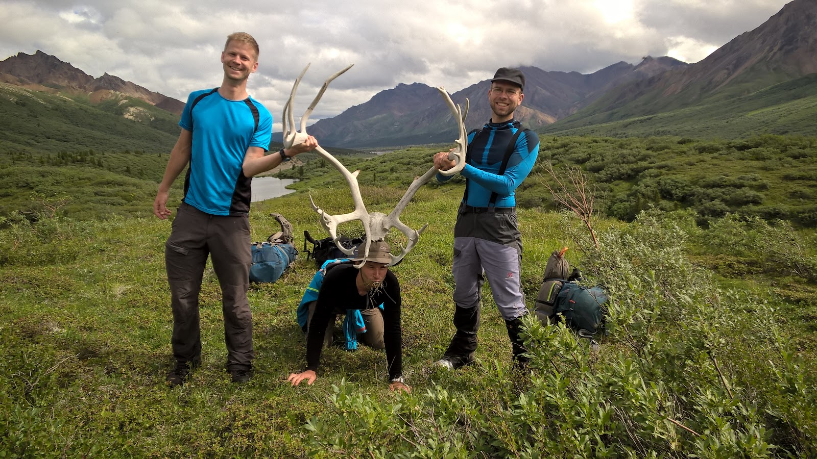
After a bit of walking, we caught a wild caribou by its antlers, while it was eating grass.
At one point Martin’s shoes broke, so I lent him my spare pair. 2 hours later, my shoe broke too, so I took back my spare shoes and he repaired one of his shoes. The shoe problems slowed us down, so the whole day we only hiked on the Teklanika River bed. Even though it was a very long day with large backpacks, I set my alarm to 5 AM, hoping for a steep early morning hike.
Saturday
We went to bed before 10 PM and I woke up at 4 AM unable to sleep. I shook Petrž, asking him if he wants to go on a hike. Fortunately, he’s one of the few people who says yes to such proposals at 4 AM, so off we went. The views before and after sunrise were stunning.
 |
| Before sunrise |
 |
| After sunrise |
After coming back from the hike, we packed our camp and hiked back along Teklanika. We crossed Teklanika for one last time before it became impassable 2 kilometers downstream where another river flows in. The stream was already very strong here, so we’ve employed a strategy recommended by rangers: make a human train by holding the backpack of a person in front of you.
 |
| Human train |
No wonder Christopher McCandless (of
Into the Wild fame) decided not to cross the same river 30 kilometers downstream and this contributed greatly to his death.
At one point we needed to pass through a forest without trails, so I took a bearing on my compass and we followed it. After some time we realized we ended up at a wrong place. The map claimed Magnetic North Pole is 25 degrees to the east of geographic north but perhaps I added 25 instead of subtracting 25, which would lead to a 50-degree error. Also, the map was issued in 1954 and the Magnetic North Pole shifted
by good 30 degrees since then. My error or not, we corrected our direction and continued walking. After another hour of walking, we were excited when we saw the road and the bus. My legs had at least 147 scratches from vegetation, which is a typical result of a tough orienteering race and not of a hiking trip.
Back at Denali Visitor Center, me and Martin said goodbye to our shoes after 10 years of dedicated service. We drove south and saw the peak of Denali twice, having a better view at Denali Viewpoint South. Denali used to be called Mount McKinley for a century but recently changed its name back to the old one used by locals for centuries. Inspired by those two names, we combined both into one: McDenaley.
 |
| McDenaley, 6190 meters |
McDenaley is 6190 meters high, which makes it the highest mountain of Northern America. It’s also one of the most prominent peaks in the world, being about 2 kilometers higher than anything else nearby. Despite its shape, it’s not a volcano but a gigantic stone pushed up from the ground.
Sunday
This was a lazy day for us. In the afternoon we went for a very short hike from Whittier to Portage Glacier and Lake. An awesome place for a swim!
 |
| Portage Glacier and Lake |
 |
| Just a normal summer activity: hanging out with friends on a sunny day by the lake. |
Back at the beach, the people watching were in awe and a few women were blushing. Somehow I didn’t feel like we achieved much: it was the warmest water we encountered in Alaska (10–11 degrees Celsius), the air was warm too and the ice not as bad as you would expect. Just the other day I was crossing an ice-cold glacier river at 4 AM and yelling at the whole valley, because I experienced double pain: from the ice-cold water and sharp stones cutting into my bare feet. That was more impressive but it doesn't look like that to bystanders.
Enough with the photos, we have to hurry to make it through Anderson Tunnel in time, so that Petrž can catch his flight. After a few steps, Roman discovered that the ice cut his foot open, so we quickly fix it and continue. I’ve also seen blood dripping from Petrž’s foot, but he didn’t even put a band-aid on it.
Monday
Monday morning, time for climbing. The instructions in the
Mountain Project guide missed an extra trail fork, so we ended up at a different crag that was much harder. The descriptions of Lower and Upper Pivot Point crags are very similar too, both having a large crack on the left side. On a positive note, Roman led his first 5.10a (thinking it was a 5.8). Me and Martin tried climbing it too, but it was beyond our skills.
 |
| Climbing at Lower Pivot Point. Roman is unknowingly leading a 5.10a. |
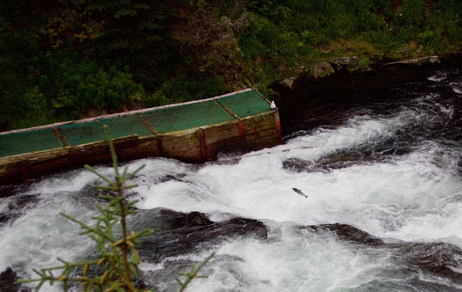
Disappointed by the tough Alaskan climbing ratings, we decided to go salmon and bear watching to Cooper Landing instead. We didn’t see bears, but we saw some salmon jumping upstream. Impressive creatures!
 |
| Salmon jumping Russian River Falls. |
It was time for all three of us to fly home, so this magnificent trip came to its end.
Lucky Coincidences
People often complain about bad luck, but we had too much luck this time. It started already in Princeton.
- Friday before the wedding, I wanted to visit Princeton Plasma Physics Laboratory, but it’s open for visitors only twice a month. Bummer! Then I went to check if it happened to be open on that day and sure it was!
- A huge storm started while walking through the Princeton University campus. Luckily, we were under the Blair Arch right when the storm started, so we didn’t catch a single drop.
 |
| Under Blair Arch |
- The 4 of us brought 5 pairs of hiking shoes in total to Denali National Park. During the second day we got down to 7 good shoes when Martin managed to repair one, so we were back to 8 shoes. Fortunately, my right shoe and his left shoe were still working, so he combined the two into a pair. Also, luckily we have similar shoe sizes.
 |
| Left shoe repaired, right shoe 5 kilometers before breaking. |
- It rained only once while we were hiking in Denali. It started 15 minutes after we finished pitching tents, so we took a half-hour nap in the tents and continued hiking once the storm was over.
- On both our wilderness trips, we haven’t met a single person.
- We didn’t die.
Alaskan Philosophy
Petrž and Roman got all philosophical on social media, claiming that Alaskan wilderness changed them substantially. There are no people, no trails, no bridges over the rivers, no phone signal. You can only rely on your friends and things you brought with you. I haven’t been as touched as them, probably because I’ve experienced something similar but
40 degrees Celsius colder and with no visibility three years ago in Northern Sweden.
A few days after the trip I’ve made a regular testosterone test and got 40% higher value than last year’s average. Perhaps Alaska turns you into a man (it probably doesn’t). Seriously though,
Alaska changed me at least a bit, because we met animals on every step and had to act accordingly. It wasn’t just bears but also moose, caribou, beavers, eagles, salmon, mosquitoes, etc. On
a recent trip to Swiss Alps, we didn’t meet many animals, so the mountains felt empty and half dead.
Photos
A selection of my photos is
on Flickr. An album merged from many cameras is on
Google Photos, including photos from Princeton (if you click on “(i)” in the upper right corner, you get to see my captions).
P.S. This was the longest trip I took for non-business reasons, so I bumped my regular donation to CarbonFund. If you aren’t offsetting your carbon use, you should consider it. Also, let me know if you know a better alternative to CarbonFund.
P.S2. Also read Petrž's post if you understand Slovak.